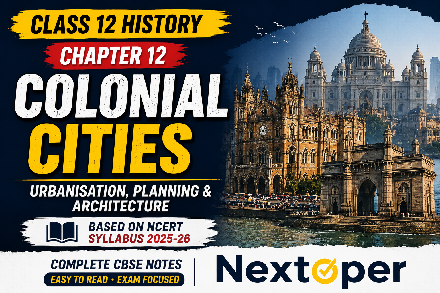
Class 12 History Chapter 12 Notes | Colonial Cities 2025-26
Last Updated: May 2025 | Based on CBSE Syllabus 2025-26 |
Class 12 History Chapter 12 Notes cover one of the most interesting topics in CBSE History. This chapter is called Colonial Cities: Urbanisation, Planning and Architecture. It is based on the official NCERT textbook for 2025-26 syllabus.
In this chapter, you will learn how three big cities grew during British rule. These cities are Madras (Chennai), Calcutta (Kolkata) and Bombay (Mumbai). You will also learn how buildings were used to show power. And you will learn about social changes in these new cities.
These notes are 100% free. No signup required. All content is based on the official NCERT textbook and CBSE syllabus 2025-26.
Table of Contents
- Chapter Overview
- Pre-Colonial Towns in India
- How We Learn About Colonial Cities
- What Were Colonial Cities Like?
- Segregation, Town Planning and Architecture
- Important Definitions and Key Terms
- Important Questions and Answers
- MCQs — 10 Questions with Answers
- Quick Revision Points
- Previous Year Questions (PYQs)
- Featured Snippet Answer Block
- People Also Ask (FAQs)
Chapter Overview Table
| Topic | Details |
|---|---|
| Chapter Name | Colonial Cities: Urbanisation, Planning and Architecture |
| Chapter Number | 12 (Theme Twelve) |
| Subject | History (Themes in Indian History Part III) |
| Class | 12 |
| Board | CBSE |
| Session | 2025-26 |
| Source | NCERT Official Textbook |
Class 12 History Chapter 12 Notes — Key Topics
Here are the main topics covered in Class 12 History Chapter 12 Notes:
- Pre-colonial towns and what made them special
- How British rule changed Indian cities
- Colonial records, maps and census data
- Growth of Madras, Calcutta and Bombay
- White Town vs Black Town — racial segregation
- Hill stations and cantonments
- Social life in new colonial cities
- Town planning in Calcutta
- Architecture of Bombay — Neo-Classical, Neo-Gothic, Indo-Saracenic
- What buildings tell us about power
Pre-Colonial Towns in India
What Made Old Towns Different?
Before British rule, towns were very different from villages. People in villages grew food and reared animals. Towns had artisans, traders, rulers and administrators.
Old Indian towns were surrounded by walls. These walls showed that towns were separate from the countryside. But the boundary was not always firm. Peasants moved to towns during famines. Traders went to villages to sell goods.
Mughal Towns
During the 16th and 17th centuries, Mughal towns were very grand. Cities like Agra, Delhi and Lahore were famous for beautiful buildings and large populations. The emperor lived in a fort. The city had gardens, mosques, temples and bazaars.
Remember this! The focus of a Mughal town was the palace and the principal mosque.
South Indian Towns
In South Indian towns like Madurai and Kanchipuram, the temple was the main focus. These towns were also important trading centres. Religious festivals often happened along with trade fairs. The ruler was the highest authority and patron of temples.
Changes in the 18th Century
Everything started changing in the 18th century. Mughal power weakened. Old towns like Delhi and Agra lost their importance. New regional capitals like Lucknow, Hyderabad and Pune grew stronger.
European trading companies had set up bases earlier:
- Portuguese in Panaji — 1510
- Dutch in Masulipatnam — 1605
- British in Madras — 1639
- French in Pondicherry — 1673
After the Battle of Plassey in 1757, the British took control of Bengal. Colonial port cities — Madras, Calcutta and Bombay — became the new economic capitals by around 1800.
How We Learn About Colonial Cities
Colonial Records and Maps
The British kept detailed records. They made maps, collected data and published official reports. These records help historians study colonial cities today.
The Survey of India was set up in 1878. Maps showed rivers, hills and roads. They helped the British plan cities, collect taxes and control trade.
What maps hide: Large settlements of the poor were often not marked on maps. This meant those areas were assumed to be empty. The poor were later evicted when development plans came.
Census Data
The first all-India census was attempted in 1872. From 1881, censuses were held every 10 years (decennial). These records are very useful. But they also have problems.
Census data can be misleading because:
- People refused to cooperate
- Upper-caste people did not give information about women
- People claimed higher-status identities
- Deaths and illnesses were not always reported
Urbanisation in India (1891–1941)
| Year | Urban Population (%) |
|---|---|
| 1891 | 9.4% |
| 1901 | 10.0% |
| 1911 | 9.4% |
| 1921 | 10.2% |
| 1931 | 11.1% |
| 1941 | 12.8% |
Between 1900 and 1940, urban population grew only from 10% to about 13%. Urbanisation in India was very slow.
What Were Colonial Cities Like?
Ports, Forts and Services
By the 18th century, Madras, Calcutta and Bombay became important ports. The British East India Company built forts for protection:
- Madras — Fort St George
- Calcutta — Fort William
- Bombay — The Fort
From the beginning, Europeans and Indians lived separately. Europeans lived inside the fort area. This was called the “White Town.” Indians lived outside. This was called the “Black Town.”
Once the British gained political power, this racial separation became even stronger.
Railways Changed Everything
Railways came to India in 1853. This linked interior areas (called the hinterland) to port cities. Raw materials could now be easily sent to ports. Workers came from villages to the cities.
After 1850, cotton mills were set up in Bombay. Jute mills were built near Calcutta. This was the beginning of modern industry in India.
Easy! Two proper industrial cities existed: Kanpur (leather and textiles) and Jamshedpur (steel). India never became a fully industrialised country due to discriminatory colonial policies.
A New Urban Milieu
Colonial cities reflected the mercantile culture (trade-based culture) of the British rulers. Along the shore were docks, offices and banks. Inland were the Company’s main offices. The Writers’ Building in Calcutta was one such office.
After the Revolt of 1857, the British became more fearful. They built separate spaces called Civil Lines where white people could live safely. Cantonments — military areas — were also set up.
First Hill Stations
Hill stations were another new feature of British India. They were built for the army at first. Later they became holiday destinations for the British.
| Hill Station | Year Founded | Reason |
|---|---|---|
| Simla (Shimla) | 1815-16 | Gurkha War |
| Mount Abu | 1818 | Anglo-Maratha War |
| Darjeeling | 1835 | Taken from Sikkim |
In 1864, Viceroy John Lawrence officially moved to Simla every summer. Simla became the summer capital of British India. Hill stations had European-style buildings, churches and gardens. They were built to feel like home for the British.
Segregation, Town Planning and Architecture
Settlement and Segregation in Madras
In 1639, British merchants built a trading post in Madraspatam. This was locally called Chenapattanam. Fort St George became the White Town. It was a separate area with walls and gates.
Only Europeans and Christians were allowed inside the Fort. The Black Town developed outside. It had weavers, artisans and middlemen.
Important communities in Madras:
- Dubashes — Indians who spoke two languages; they worked as agents
- Vellalars — first to get Company jobs
- Brahmins — competed later with spread of English education
- Telugu Komatis — controlled the grain trade
- Paraiyars and Vanniyars — formed the labouring poor
Madras grew by absorbing surrounding villages. This gave it a wide, semi-rural character.
Town Planning in Calcutta
Modern town planning started in colonial cities. In 1756, the Nawab of Bengal, Sirajudaula, attacked and sacked Calcutta’s small fort. After defeating him at the Battle of Plassey in 1757, the British built a new, stronger Fort William.
Around the new fort, they left a huge open space called the Maidan (or garer-math). This was so soldiers inside the fort could fire at any advancing enemy without obstruction. This became Calcutta’s first major town planning step.
In 1798, Lord Wellesley became Governor General. He built the grand Government House. He was worried about the crowded and dirty Indian parts of the city. In 1803, he wrote a Minute (an order) about improving town planning.
The Lottery Committee (1817) continued town planning. Money was raised through public lotteries. The committee built roads and cleared river banks. But this also pushed the labouring poor to the edges of the city.
Cholera spread from 1817 and plague appeared in 1896. The British used disease fears to demolish poor people’s huts (called bustis) and develop the White Town areas more. Indian representatives protested. This strengthened anti-colonial feelings.
Architecture in Bombay
Bombay was originally seven islands. As the population grew, the islands were joined together. By the end of the 19th century, half of India’s imports and exports passed through Bombay.
Three main architectural styles were used in Bombay:
Difference Between Architectural Styles in Bombay
| Style | Features | Examples |
|---|---|---|
| Neo-Classical | Geometric shapes, tall pillars, inspired by ancient Rome | Town Hall (1833), Elphinstone Circle |
| Neo-Gothic | High-pitched roofs, pointed arches, detailed decoration | Secretariat, University of Bombay, Victoria Terminus |
| Indo-Saracenic | Mix of Indian and European — domes, chhatris, jalis | Gateway of India, Taj Mahal Hotel |
Neo-Classical buildings looked like ancient Roman temples. The British thought this style showed their empire’s greatness. The Town Hall in Bombay (1833) is an example.
Neo-Gothic had roots in medieval European churches. Victoria Terminus (now CST) is the most famous Neo-Gothic building. Indians like Sir Cowasjee Jehangir Readymoney funded some of these buildings.
Indo-Saracenic was a mix of Indian and European styles. It combined domes and arches from medieval Indian buildings with European designs. The British used this style to show they were “legitimate rulers” of India. The Gateway of India (built to welcome King George V in 1911) is the best example.
Chawls — The lack of space in Bombay led to a unique building type called the chawl. These were multi-storeyed buildings with single-room apartments and shared corridors. They built a strong sense of community among workers.
Important Definitions and Key Terms
| Term | Meaning |
|---|---|
| Qasbah | A small town in the countryside, often home to a local notable |
| Ganj | A small fixed market dealing in cloth and food items |
| Kotwal | Imperial officer who managed policing and internal affairs of a town |
| Dubash | An Indian who could speak two languages — local language and English |
| Maidan | Large open space around Fort William in Calcutta |
| Busti | Originally meant settlement; later used by British to mean makeshift huts of the poor |
| Chawl | Multi-storeyed single-room apartment buildings unique to Bombay |
| Cantonment | Area where Indian troops under European command were stationed |
| Civil Lines | Separate residential areas for white people built after 1857 |
| Hinterland | The countryside connected to a port city that supplied raw materials and labour |
| Neo-Classical | Architectural style inspired by ancient Rome with pillars and geometric shapes |
| Neo-Gothic | Architectural style with high roofs and pointed arches from medieval Europe |
| Indo-Saracenic | Hybrid style combining Indian and European architectural features |
| Decennial census | Census conducted every 10 years; started in India from 1881 |
Important Questions and Answers
2-Mark Questions
Q1. What do the terms “White Town” and “Black Town” signify?
White Town was the area inside the fort where Europeans lived. Black Town was the area outside where Indians lived. This division showed racial segregation — the idea that Europeans were superior to Indians. Once the British gained political power, this separation became even stronger.
Q2. What is a “busti”?
Busti originally meant a neighbourhood or settlement in Bengali and Hindi. The British changed its meaning to refer to makeshift huts built by the poor. In the late 19th century, the British used “bustis” to mean insanitary slums. They often demolished these areas under the excuse of improving public health.
Q3. What were cantonments?
Cantonments were military areas where Indian troops under European command were stationed. They were developed after 1857 as safe areas for British rulers. They had broad streets, bungalows with gardens, barracks, a parade ground and a church.
Q4. What was the Lottery Committee?
The Lottery Committee (1817) was a committee that raised money for town improvement in Calcutta through public lotteries. It commissioned a new map of Calcutta and carried out road building and river bank clearing. Its work pushed the labouring poor to the outskirts of the city.
5-Mark Questions
Q5. How did concerns of defence and health shape town planning in Calcutta?
Calcutta’s town planning was shaped by two main concerns — defence and health.
For defence: After the Nawab of Bengal attacked Calcutta in 1756, the British built a new and stronger Fort William in 1757. Around this fort, they cleared a large open space called the Maidan. This space allowed soldiers inside the fort to fire directly at any enemy. This became Calcutta’s first major town planning measure.
For health: By the early 19th century, the British became worried about disease spreading from the crowded Indian areas to the European areas. Cholera spread from 1817 and plague appeared in 1896. The government demolished bustis and cleared areas they called insanitary. They also built underground piped water, sewerage and drainage systems. However, this “health-based” planning mostly benefitted the White Town. Indian representatives protested against this unfair treatment.
Q6. What are the different colonial architectural styles seen in Bombay?
Three main styles were used in Bombay:
Neo-Classical style was inspired by ancient Roman buildings. It used tall pillars and geometric shapes. The Town Hall (1833) and Elphinstone Circle were built in this style. The British believed a style linked to imperial Rome could express the glory of their own empire in India.
Neo-Gothic style came from medieval European churches. It had high-pitched roofs, pointed arches and rich decoration. Buildings like the Secretariat, University of Bombay, High Court and Victoria Terminus were built in this style. Indians like Sir Cowasjee Jehangir Readymoney donated money to build some of these structures.
Indo-Saracenic style combined Indian and European features. It used domes, chhatris, jalis and arches from medieval Indian buildings along with European elements. The Gateway of India (1911) and the Taj Mahal Hotel are the best examples. The British used this style to claim they were the natural rulers of India.
📚 Want More Free Notes? Visit Nextoper.in for all Class 9 to 12 CBSE Notes — 100% Free!
MCQs — 10 Questions with Answers
Q1. When did Company agents first settle in Madras? a) 1600 b) 1639 ✅ c) 1661 d) 1690
Q2. Which city was given to the English king as part of his wife’s dowry? a) Madras b) Calcutta c) Bombay ✅ d) Surat
Q3. What was the first all-India census attempted? a) 1857 b) 1872 ✅ c) 1881 d) 1891
Q4. The Maidan in Calcutta was created around which fort? a) Fort St George b) Fort William ✅ c) Fort Bombay d) Red Fort
Q5. Which architectural style features high-pitched roofs and pointed arches? a) Neo-Classical b) Indo-Saracenic c) Neo-Gothic ✅ d) Palladian
Q6. Victoria Terminus railway station in Bombay is an example of which style? a) Indo-Saracenic b) Neo-Gothic ✅ c) Neo-Classical d) Mughal
Q7. Who wrote the famous Minute on Calcutta town improvement in 1803? a) Lord Dalhousie b) Lord Wellesley ✅ c) Lord Cornwallis d) Viceroy Lawrence
Q8. What does “Dubash” mean? a) A type of fort b) A person who speaks two languages ✅ c) A type of marketplace d) A colonial architectural feature
Q9. Which viceroy officially made Simla the summer capital in 1864? a) Lord Wellesley b) Lord Dalhousie c) Lord Canning d) John Lawrence ✅
Q10. The Gateway of India was built in which architectural style? a) Neo-Gothic b) Neo-Classical c) Indo-Saracenic ✅ d) Palladian
Quick Revision Points
Here are the most important points from Class 12 History Chapter 12 Notes. Remember these for your board exam!
- Madras, Calcutta and Bombay were originally fishing and weaving villages.
- Company agents arrived in Madras (1639), Calcutta (1690); Bombay was given as a dowry (1661).
- Pre-colonial towns: Mughal cities focused on palace and mosque; South Indian towns focused on temple.
- The first all-India census was attempted in 1872; decennial censuses started in 1881.
- White Town = European area; Black Town = Indian area — this showed racial segregation.
- Fort William built in Calcutta after Battle of Plassey (1757); the Maidan cleared for line of fire.
- Lord Wellesley wrote the 1803 Minute on Calcutta town planning.
- Lottery Committee (1817) raised funds for town improvement through lotteries.
- Hill stations were founded for army needs; Simla became summer capital in 1864.
- After 1857 Revolt, Civil Lines and Cantonments were expanded as safe European areas.
- Bombay was originally seven islands that were gradually joined together.
- Three architectural styles in Bombay: Neo-Classical, Neo-Gothic, Indo-Saracenic.
- Victoria Terminus (CST) — best example of Neo-Gothic.
- Gateway of India (1911) — best example of Indo-Saracenic.
- Chawls are multi-room buildings unique to Bombay that built community solidarity.
Previous Year Questions (PYQs)
Q1. Explain the difference between White Town and Black Town in colonial cities. (CBSE 2019, 3 marks)
White Town was the European residential area, usually inside or near the fort. It had broad streets, bungalows and European buildings. Black Town was the Indian residential area outside the fort. It had narrow lanes, bazaars, temples and caste-specific neighbourhoods. This division reflected racial separation in colonial India.
Q2. How did railways affect urbanisation in colonial India? (CBSE 2018, 3 marks)
Railways introduced in 1853 changed the growth of towns. Old towns on river routes declined. Railway stations became new collection points for raw materials and distribution centres for imported goods. Railway towns like Jamalpur and Bareilly developed. Railways also linked port cities to the hinterland, making it easier to send raw materials and bring workers to the cities.
Q3. What is Indo-Saracenic architecture? Give two examples. (CBSE 2020, 3 marks)
Indo-Saracenic was a hybrid architectural style that combined Indian and European features. It used domes, chhatris, jalis and arches from medieval Indian buildings along with European structural elements. Examples: The Gateway of India (Mumbai) built in traditional Gujarati style in 1911, and the Taj Mahal Hotel built by Jamsetji Tata. Indo-Saracenic flourished especially in Madras.
Q4. Examine the role of census in understanding colonial urbanisation. (CBSE 2017, 5 marks)
The census was an important tool for studying urbanisation. From 1881, decennial censuses provided data on population growth, occupations, castes and disease. However, census data has limitations. People refused to cooperate. Upper-caste people hid information about women. People claimed higher-status identities. Deaths and illnesses were under-reported. Census commissioners often created arbitrary categories that missed the fluid identities of people. Despite these problems, census data remains a valuable source for studying colonial cities.
Featured Snippet Answer Block
What is Class 12 History Chapter 12 about?
Class 12 History Chapter 12 is about Colonial Cities — Urbanisation, Planning and Architecture. It explains how Madras, Calcutta and Bombay grew from small fishing villages into big colonial cities under British rule. It covers the growth of White Town and Black Town, town planning, hill stations, architecture styles like Neo-Gothic and Indo-Saracenic, and social changes in colonial India. This chapter is part of the NCERT 2025-26 syllabus.
People Also Ask — 5 PAA Questions
Q: What is the main theme of Class 12 History Chapter 12?
Class 12 History Chapter 12 explores how British colonial rule transformed Indian cities. It covers urbanisation in Madras, Calcutta and Bombay, racial segregation through White Town and Black Town, town planning driven by defence and health concerns, architectural styles that expressed British power, and social changes like the rise of a middle class and new roles for women. All content is based on the NCERT 2025-26 textbook.
Q: What is the difference between White Town and Black Town in colonial India?
White Town was the area inside or near the fort where Europeans lived. It had spacious bungalows, clubs and European-style buildings. Black Town was the Indian area outside the fort. It had narrow lanes, bazaars, temples and caste-specific neighbourhoods. This separation was based on race and religion and showed how the British maintained social and political control over Indians in colonial cities.
Q: What are the three architectural styles used in Bombay?
Three architectural styles were used in colonial Bombay. Neo-Classical had tall pillars and geometric shapes inspired by ancient Rome. Neo-Gothic had high-pitched roofs and pointed arches from medieval European churches — Victoria Terminus is the best example. Indo-Saracenic mixed Indian domes and arches with European design — the Gateway of India is the most famous example. These styles expressed British power and helped make Bombay into an impressive imperial capital.
Q: Why were hill stations built during colonial rule in India?
Hill stations were built primarily for the British army. Cool hill climates were seen as healthier than India’s tropical heat. Simla was founded during the Gurkha War (1815-16), Darjeeling was taken from Sikkim in 1835. They were used to rest sick soldiers and guard frontiers. In 1864, Viceroy John Lawrence made Simla the official summer capital. Railways later made hill stations accessible to Indian elites too, ending their status as purely European spaces.
Q: How did the British use census data in colonial cities?
The British used census data to track urban growth, classify occupations, and plan taxation and governance. The first all-India census was attempted in 1872, and regular decennial censuses started in 1881. However, census data was often unreliable — people refused to cooperate, identities were misclassified, and deaths went unrecorded. Historians must use census data carefully, keeping in mind its biases, to reconstruct colonial urbanisation patterns accurately.
Conclusion
Class 12 History Chapter 12 Notes help you understand how British rule completely changed Indian cities. You learned how Madras, Calcutta and Bombay grew from small villages into big colonial capitals. You also learned about racial segregation in White Town and Black Town, town planning driven by defence and health fears, and architectural styles that showed British power. Architecture is not just about buildings — it tells us about power, identity and culture.
For your CBSE 2025-26 board exam, focus especially on architectural styles, the Maidan and Fort William story, hill stations and the role of census data. Practice the MCQs and PYQs in these Class 12 History Chapter 12 Notes. You got this!
More Notes from This Subject
- Class 12 History Chapter 11 Notes — Rebels and the Raj
- Class 12 History Chapter 10 Notes — Colonialism and the Countryside
- All Class 12 History Chapter Notes — Nextoper.in
Author Bio
This article is written by the Nextoper Editorial Team. We provide free CBSE study notes for Class 9 to 12 students. All our notes are based on the latest NCERT syllabus 2025-26. Our content is verified by subject experts and updated regularly to match the latest CBSE exam pattern.
Reference: NCERT Official Website
This blog was last reviewed and updated in May 2025 to match the latest NCERT and CBSE guidelines for the 2025-26 session.
Note: All notes are based on the official NCERT textbook and CBSE syllabus 2025-26.
━━━━━━━━━━━━━━━━━━━━━━━━━━━━━━━━━Nextoper Notes ━━━━━━━━━━━━━━━━━━━━━━━━━━━━━━━━━



I like how these notes connect urban planning with the social impact of British rule instead of just listing facts. The section on segregation and architecture is especially important because it helps students understand how colonial cities like Bombay, Madras, and Calcutta were designed to reflect power and control. This looks like a useful revision resource for quickly covering the main NCERT themes before exams.